2021 Hike 18: Lookout Mountain - Winthrop

The next hike was at a fire lookout called, appropriately, Lookout Mountain. This hike was interesting to me, because several of my family, including my Dad, Mom, and Uncle Phil, were in the Forest Service. I felt like I got to glimpse a bit into my family’s past in this hike.

It starts off at the top of a forest service road, and believe it or not, this was Brook’s first experience on one of these roads! One of the differences between the National Parks and National Forest, is that the National Parks (and State Parks for that matter) usually have well-paved, maintained, and monitored roads and parking areas; the National Forest…does not.

Brookie gets her first introduction to a Forest Service road!  She refuses to believe that this road was actually in comparatively good repair…wait until the next one…

Brookie gets her first introduction to a Forest Service road! She refuses to believe that this road was actually in comparatively good repair…wait until the next one…

So after several passes over a few craters here and there, and what can only be described as boulders, we were able to get our Sentra up to the trailhead! Proof that unless weather conditions are terrible, it’s really more about the attention and conscientiousness of the driver, than about the vehicle that they’re driving.

This hike was a good deal more steep in elevation; it was about 1200 feet gain, but only over about 1.75 miles in distance, so it was a bit of a burner! Totally worth it though. The beginning of the trail had a bunch of wildflowers in bloom, which was really cool to see; Neither Brook nor I have been hiking high enough at this point in the year to be able to see these.

After about 1000 feet up, the trail levels off, and follows the ridgeline until it goes up the last couple hundred feet to the lookout at the top.
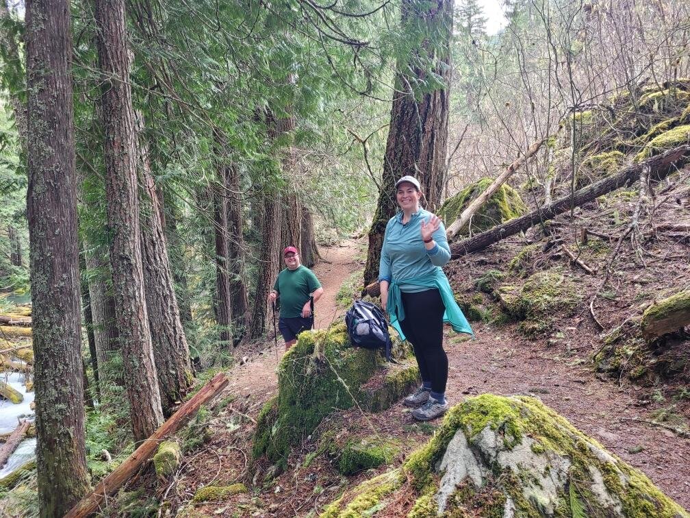
Along the ridgeline

Along the ridgeline

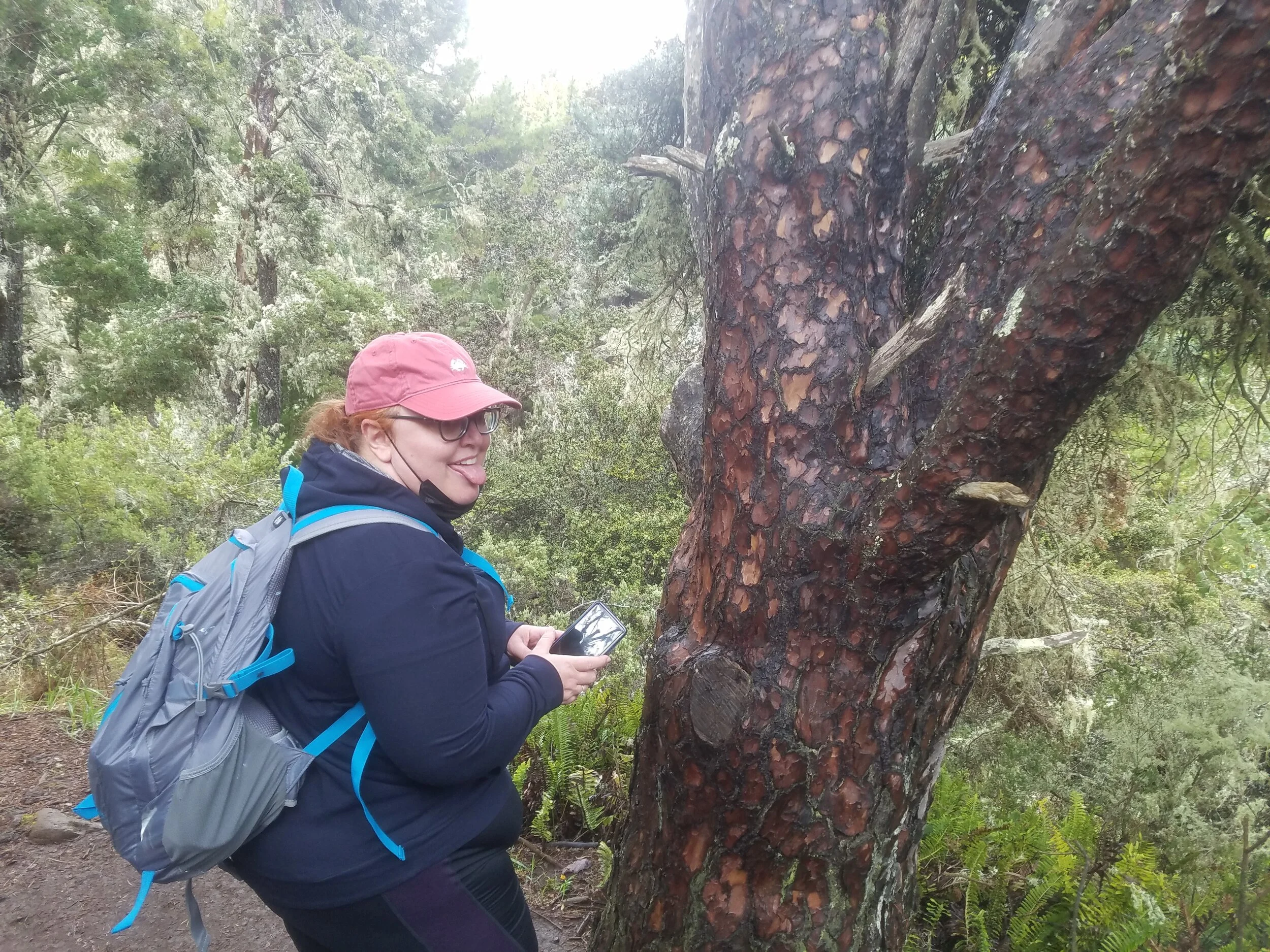
One of the more obscure traditions that once existing in my extended family, was taking pictures of each other taking pictures. I am not sure why we found this so amusing, but we did. The proof still exists today in old albums. So I thought this would be a nice homage to my aunts and uncles at the peak. Aunt Susie and Aunt Carroll, this is for you:

Brook taking a picture of me

Brook taking a picture of me

Me taking a picture of Brook

Me taking a picture of Brook

I was too chicken to attempt climbing into the lookout, but Brook was not, so I got a good picture of her hanging out up top.

The old fire lookout

The old fire lookout

Brookie in the lookout

Brookie in the lookout

Taking my picture from the lookout

Taking my picture from the lookout

Since this was originally intended as a fire watch lookout, you can see a 360 degree view from this point. Great hike, and again lucked out with beautiful weather; slightly overcast, so not too hot, and no bugs! I would definitely do this hike again. Maybe next time, I’ll venture into the lookout.

Cool Black and White photo Brook took from the ladder inside the lookout

Cool Black and White photo Brook took from the ladder inside the lookout

Hike 17: Diablo Lake Trail - Winthrop

One weekend, we took a quick trip to the beautiful area around Winthrop Washington over the North Cascades Highway. This highway is wonderful for trails, and we were able to do a large portion of the trail along Diablo Lake. We lucked out on weather, as it was clear, but before the big heat wave that came through in mid-July.

Yep…it’s backwards!  We still can’t seem to figure out the camera on Brook’s new phone, lol

Yep…it’s backwards! We still can’t seem to figure out the camera on Brook’s new phone, lol

The gain was about 1500 feet over the course of 4 miles in, so a nice gentle ascent.

Brookie getting ready to go!

Brookie getting ready to go!

Diablo Lake is an unusually beautiful turquois color from particles of silt that were created from glacial till, and now lie suspended in the lake, reflecting the light in this manner.

A turquois Diablo Lake

A turquois Diablo Lake

After a tough year in 2020, I feel very thankful that I’m able to get out and see some of this stuff again, and I feel very luck that I live so close to this wonderful countryside.

Brook and I sitting at the end of the trail

Brook and I sitting at the end of the trail

2021 Hike 16: Cedar River Trail

In this trail, we did something a little different from the norm: an urban trail. It was very flat, and very long. We didn’t do the whole thing, but it was a haul! An interesting thing about the Cedar River trail, is it was actually part of the Milwaukee road, a route that connected a railway from Kentucky to the Puget Sound. It was decommissioned and abandoned in the 1970s, but the trail remains. This is a cool hike, because Brook and I live in Renton, so welcome to our home!

The Cedar River

The Cedar River

Brook “Vanna-ing” the Cedar River Trail.

Brook “Vanna-ing” the Cedar River Trail.

The interesting thing about urban trails, is that you can see so many different things in one hike. We started off at the mid point, which was fairly heavily wooded, and next to a couple of small parks here and there.

This would not be a great singles event for ducks…5 guys, 3 girls!

This would not be a great singles event for ducks…5 guys, 3 girls!

As we went closer in, the trail actually took us through downtown Renton along some cool bridges, brick paths, and some tunnels that smelled…..not great. One of the aspects of being in a city I suppose.

Another cool thing about this trail, is it takes us past the Renton Boeing plant, which is awesome, because I’ve always been an airplane fanatic, particularly jet aircraft.

An Ural Airlines 737, likely here for maintenance

An Ural Airlines 737, likely here for maintenance

This trail is a very cool cross-section of life in my town, and I am happy to call Renton home.

Me and Brookie

Me and Brookie


2021 Hike 15: Mt. Washington

On this hike, I went up to the summit of Mt. Washington. Mt. Washington is one of the toughest hikes I have done, but the views were incredible! On this hike, I broke 3200 feet in elevation, which is fantastic, because it’s getting really close to where I used to be when Dad and I hiked together. The trail actually starts off at John Wayne Pioneer trail, which is a 110 mile jaunt from Rattlesnake Lake near Issaquah to the Washington-Idaho border.

The John Wayne Pioneer Trail

The John Wayne Pioneer Trail

After about a half mile on the John Wayne trail, there is a turnoff that begins going up…for a long time. You ascend about 3200 feet in about 4.5 miles. Thankfully, there are places where it is level, so you can catch your breath.

The first break in the trees, about 700 feet up

The first break in the trees, about 700 feet up

Several streams actually cut over the trail, so my poles came in super handy.

A creek crossing the trail

A creek crossing the trail

What I didn’t expect, was the snowfield! After going up about 2500 feet, there was actually snow leftover in June! This was pretty cool to see, and I always love being able to walk through different climate zones on the same trail. It reminded me of traversing the snow and scree trails with Dad by Egg Lake, west of Copper Mountain. There is something surreal about traversing snow in 80 degree weather.

Snow pack on the trail

Snow pack on the trail

I thought I’d gotten near the top of the mountain when I hit the snow…I was very wrong. There was still about 1000 feet left to go! The last little stretch is tight switchbacks with intermittent snowpack, and some of the area is quite exposed. Some of the boulder scramble was difficult, but I never felt unsafe. On the exposed section near the summit, I learned that frequent breaks are okay, and that we need to proactively hydrate even when we’re not thirsty. I did not do this, and ended up getting nauseous during one of the exposed parts. I had to sit in the shade and slowly drink water until I felt better, then really try to pace myself, no matter how excited I am to almost be done.

Mt. Si and the “Haystack” scramble in the distance

Mt. Si and the “Haystack” scramble in the distance

Finally at the summit, it was one of the most rewarding views I have ever seen. It was a wonderfully clear day, so I was able to see Mt. Baker from the north face, and Mt. Rainier from the south face.

Mt. Baker from the North face

Mt. Baker from the North face

Mt. Rainier from the South face

Mt. Rainier from the South face

On the trail, a fellow hiker agreed to take my picture in the pose that Dad did on the way to Copper Lake so long ago. She is unfortunately not named in this blog post, because I forgot to ask for consent to publish on the website. Information security is very important to me, so I want to honor peoples’ privacy. This might be a good time to note that everyone on this blog has given me consent to publish; if you go on a hike with me, you will never be unknowingly broadcast over the internet. If the person I met on Mt. Washington happens to read this though, and wants to be on the blog, that person can absolutely shoot me a quick message providing consent to publish, and I would be happy to make edits. :)

Couldn’t resist doing the pose that Dad did 20 years ago

Couldn’t resist doing the pose that Dad did 20 years ago

Dad on the trail to Hannegan Pass

Dad on the trail to Hannegan Pass

As I was coming back down from the mountain, I couldn’t help but think that Dad was still sending me on adventures after being gone, to see the world he saw. Recently Brook showed me the movie “The Secret Life of Walter Mitty,” and that really resonated, and inspired me to climb this mountain. Coming out of my comfort zone, I was able to get some adventure, and see some of the world that Dad loved so much.

2021 Hike 14: West Tiger Mountain #1 and #2 summits

On May 8th, I did a trail that had not one, but two summits…appropriately named #1 and #2 on Tiger Mountain. I also beat my personal recent best, by doing 2500 feet in elevation! In my 20s, I was able to do quite a bit more, but that was a different time, before alcohol took over my life for a while. Since my recovery, I’ve been slowly crawling my way back up to health and personal power, and I am grateful that my body let me do this.

The High Point trailhead

The High Point trailhead

The trail I took starts out at High Point Trail, which was awesome, because it was not connected to the main park for Tiger Mountain, so I got to avoid all the crowds, and have to the trail to myself for a while.

20210508_072640.jpg

This trail is a bit muddy, but it is well maintained, and does not have the crazy bouldering and cuts that Cable Line did.

The cool thing about hiking this amount of elevation, is you actually get to see the landscape change as you go up. The photo below illustrates this, as this was taken along the ridgeline before reaching the first summit.

The changing landscape, higher in the mountains

The changing landscape, higher in the mountains

At the top of the first peak, I was greeted by this spectacular view of the Renton/Kent/Covington areas!

Me at the West Tiger mountain summit #1, looking highly amused

Me at the West Tiger mountain summit #1, looking highly amused

Thankfully, a bit of scenery actually did peek out a little, so it was not completely socked in.

A little bit of a view!

A little bit of a view!

The interesting thing about Tiger mountain, is that since it is the tallest of the peaks in what are considered the “Issaquah alps,” it is used as a broadcast center for several Seattle radio stations, as well as UHF television broadcasts.

Radio tower at the top of West Tiger 2

Radio tower at the top of West Tiger 2

Coming down on the other side of the mountain loop, I traversed a beautiful bridge named Murat’s bridge, with a sign and box called Murat’s mailbox at the end. This bridge was named for a young man named Murat Danishek, who passed away from a heart condition at the age of 33. Murat loved the outdoors. Murat, I hope your spirit is at peace, climbing mountains somewhere. Say hi to Dad for me.

Murat’s bridge

Murat’s bridge

Murat’s mailbox

Murat’s mailbox

Hike 13: Green Water Lakes Trail

On this hike, we were delighted to welcome back a good friend of ours, Leah! Leah went on several hikes with us before the pandemic, and is now back in the fold!

Leah by a waterfall

Leah by a waterfall

This hike was a beautiful National Forest trail out by Enumclaw Washington to the Green Water Lakes. Since it was way out past Enumclaw, there were not a lot of other people on the trail, so it was quite peaceful.

Brook’s photo of Green Water Creek

Brook’s photo of Green Water Creek

Along the way, we crossed several bridges, some of which were sturdier than others, and ended up at a campground.

Brook and Patrick on a log bridge

Brook and Patrick on a log bridge

Much to our endless amusement, we found random composting toilets in the middle of the woods!

Random forest toilet

Random forest toilet

We even had options, just in case one was occupied!

Discussing the merits of a two-toilet campground

Discussing the merits of a two-toilet campground

Still laughing about toilets.  Yes…we are 12.

Still laughing about toilets. Yes…we are 12.

This was a wonderful day hike, and it was so good to get outside with one of our wonderful friends. And I will remember to fill up the gas tank next time. We got back to Enumclaw…but it was a little close. That is a story for another time. Welcome back Leah, and many more hikes are in our future!

Patrick and Leah

Patrick and Leah

2021 Hike 11: Little Si

This mountain is one of my favorite places to go. Last year, we did this hike with Leah and Craig, and I was delighted to return. With the pandemic closing down most other sources of recreation, the trails have been packed. For this reason, I woke up at 6:30am on a weekday, as Brook was getting ready for work, and beat everyone to the trail.

When I reached the top of the mountain, I was the only one there, and it felt amazing.

Top of Little Si

Top of Little Si

One of the cool things about Little Si, is that there is an overlook with the same view as the peak right after the first switchback, so you can do a “before and after” shot at 30 feet, and at 1200 feet.

View from 30 feet

View from 30 feet

View from 1200 feet

View from 1200 feet

I also realized that I may be slowly turning into Ron Swanson from the show Parks and Rec…I have been known to utter things such as “why would anybody pay three times as much to have someone else change the air filter on their car? It’s two clips and a case!” or, referring to an old flower pot “Why would I volunteer for an art project, something I hate doing, on something that I care nothing about? So I threw it away.” This metamorphosis was made apparent to me as I removed bacon from my backpack. Yes, I brought emergency bacon on the trail. Just in case I felt like eating bacon on top of a mountain. Maybe I need to move to Pawnee or something.

Trail bacon!  Yes, I’m wearing a different shirt.  Protip: change your base layer at the top, and you will be nice and non-sweaty!

Trail bacon! Yes, I’m wearing a different shirt. Protip: change your base layer at the top, and you will be nice and non-sweaty!

2021 Hike 10: Soos Creek Trail

So today, we decided to ignore all practical advice given to hikers, walkers, and runners, and break in a brand-new never-worn pair of shoes on a five mile trek. The hike was…..uncomfortable. Since the Soos Creek Trail in Covington, Washington is a long, flat-ish paved trail, we figured it would be the perfect time to try our new Hokas! These shoes are great; they are like walking on clouds! However, before they are broken in, they are more like pinchy, blistery, unbalanced clouds. For this reason, we only did the 2.5 miles out and back for a total of 5 miles. This first picture is a representation for most of the things Brook and I attempt in life: we get it…..mostly right. Somehow Brook changed a setting on her phone to flip the picture to the mirror-image, and now the sign is backwards! Thankfully “Soos” is a palindrome, so we are good!

Brook and Patrick in mirror-image next to the trailhead

Brook and Patrick in mirror-image next to the trailhead

The trail and creek themselves are named after a village of the Skopamish tribe that once existed where Soos Creek joined up with the Green River. Since then, the area has been logged, and power lines established, leaving an expanse of wetlands along the trail.

The trail, bordered by wetlands on either side

The trail, bordered by wetlands on either side

Along these wetlands grow an enormous amount of aromatic skunk cabbage. If you have never smelled skunk cabbage, is smells exactly as you think it should.

So much skunk cabbage…so very stinky…

So much skunk cabbage…so very stinky…

Patrick standing next to an especially fragrant patch of skunk cabbage

Patrick standing next to an especially fragrant patch of skunk cabbage

Thankfully, we did this hike in the morning in early Spring. I cannot imagine how many giant mosquitos will be out in a late summer evening.

Resized952021042395092238.jpg

It was good to get out and get walking. A couple things I learned along the way:

  1. Speed-walking on horizontal pavement works an entirely different set of muscles than does slow, inclined hiking. This was a humbling realization, as I struggled to keep up with Brook. If I want to be able to climb Rainier, I need to have not just the strength, but the endurance to do so.

  2. Never, I mean NEVER attempt to break in a never-worn pair of shoes or boots with a lengthy trek. It does not end well.

And now, I’m off to walk in these shoes a bit more, before trying another trail in them.

2021 Hike 9: Coal Creek natural area to Red Town

Last week we went to an area very close to home: Coal Creek natural area. We also went with a friend very close to us: Nick Welch! And Nick gets the honor of being the first Hikes With Dad guest since the pandemic began! Brook has known Nick for about 25 years, and I have known Nick as long as I have known Brook; about 11.5 years.

Nick, Brook, and Patrick

Nick, Brook, and Patrick

The Coal Creek area actually lives up to it’s name; it was surveyed in the 1870s, and found to have significant amounts of coal, which was then mined from several shafts, which are still visible today. The nearby city of Newcastle was actually founded due to the coal industry in this region.

Nick, Patrick, and Brook standing in front of Coal Creek Falls.  To the left out of the shot, a mineshaft leads straight down

Nick, Patrick, and Brook standing in front of Coal Creek Falls. To the left out of the shot, a mineshaft leads straight down

With the farms bordering the area, and the previous cultivation having taken place, this trail has far less old growth, and resembles more of a pastoral, hilly area in Minnesota,. rather than the typical Pacific Northwest vegetation.

A bit of a departure from the usual conifers and ferns of the Pacific Northwest

A bit of a departure from the usual conifers and ferns of the Pacific Northwest

This trail is about 6 miles out and back, and has a modest elevation gain of 500 feet. It is a very well-maintained trail; even when part of it routinely gets washed out every other year by flooding, the parks crews always come out and get it ready for Spring. This is just another reminder of how lucky we are to live in a place that we can drive 5 minutes away, and find ourselves in a wonderful, well-cared for area.

The latest landslide over the trail.

The latest landslide over the trail.

I am also grateful to back to hiking with good friends again. Hopefully this heralds a new year with many more hikes with friends!

Patrick and Nick

Patrick and Nick


2021 Hike 8: West Tiger Mountain summit via Cable line

We are back in the Pacific Northwest! This hike I did solo, as Brook’s ankle was still recovering at the time. This is the first hike I have done (other than Copper Mountain in my 20s), that is rated as “Hard” in AllTrails. It surely lived up to its rating.

The Cable Line trail, is not a maintained trail per se…this path was originally intended as a maintenance access route for the utility workers to service the electrical line that powers the radio tower on top of the mountain.

Sign at the beginning of the trail

Sign at the beginning of the trail

When I looked this trail up, I was a bit confused as to the rating; it was only a couple miles in, and had about 1800 feet elevation; I had done trails like this recently, so I wondered why the “Hard” rating applied. I found out why for several reasons:

  1. There is very little maintenance done on the trail as the sign states. Sometimes there is a trail, but other times it is simply a collection of boulders and tree roots that are vaguely more level than the surrounding boulders and tree roots.

  2. There are no switchbacks, there is only up. Usually when I see switchbacks I’m like “Oh God, here we go.” Turns out they’re actually there to make it easier.

  3. There are literal power cables underground that are occasionally above ground on the trail. I am reasonably sure they are safe. Reasonably.

For context, the below picture was not taken looking down at the trail…it is taken at a level stance, parallel to the ground.

No switchbacks; just straight up

No switchbacks; just straight up

Power cables on the trail itself

Power cables on the trail itself

When I summitted West Tiger, I was awarded with this amazing view! Seems to be a running theme with our hikes this year so far:

The clouds and fog heard I was hiking, and wanted to stop by and say hi

The clouds and fog heard I was hiking, and wanted to stop by and say hi

I did see this pretty cool mountain bird though. I love it when I am able to hike far enough up that I can watch the fauna change. Not quite sure what this is…it was about the size of a small pigeon, but wild, much more lean, and at high elevation.

Mystery bird

Mystery bird

Since the view didn’t pan out, I wanted to prove that I actually got here.

Since the view didn’t pan out, I wanted to prove that I actually got here.

In summary, that was a crazy hike that would make an excellent training hike for alpine climbing…when I am about 60 lbs lighter.

2021 Hike 7: Pipiwai trail

As I have mentioned previously, I am continuously amazed by the climate diversity on the Hawaiian islands. This his is in the same National Park as the Haleakalā Crater hike was, but instead of having freezing rain and arctic winds, it is 85 degrees, and sweltering.

Patrick and Brook on the trail

Patrick and Brook on the trail

This hike is on the Pipiwai trail on the road to Hana. The road to Hana is an awesome drive, and fairly safe; the roads are more reminiscent of rural European roads that are technically two lanes, but have only just enough room…definitely not the types of roads that mainlanders in the U.S. are accustomed to. There was only one close call, but that was due more to driver error than any kind of road conditions.

The eastern part of Maui is more lush and vegetative, so the wildlife and domestic animals are much more prevalent; on the road to Hana we met:

  1. Cats

  2. Dogs

  3. A wild piglet that challenged us in the middle of the road, forcing us to wave our arms out the window until it moved along

  4. A cow, occupying one side of the road that we had to inch around

  5. An overly friendly pink and white goose at a food stand

  6. a weasel

  7. horses

  8. goats

The trail itself is about 3.4 miles out, and about 900 ft in elevation. As we began the ascent in 85 degree weather at 1000% humidity, I just had to reach a level of acceptance that I was going to be perpetually drenched in sweat, and that this was my life now.

The hike starts off at a pretty good upward grade, and takes us deep into the jungle, where banyan trees create an exotic canopy, and make the ground uneven in places (more on that later).

Patrick next to a giant Banyan tree for scale

Patrick next to a giant Banyan tree for scale

After crossing a couple of bridges, we found ourselves in an amazing bamboo forest. This was unlike anything I have ever seen before. If you have watched any martial arts anime at all, you will know that this is the kind of environment that ninjas hide in, and attack from.

View from a bridge on the way to the bamboo forest

View from a bridge on the way to the bamboo forest

Patrick in the distance, in the bamboo forest - beware of ninjas!

Patrick in the distance, in the bamboo forest - beware of ninjas!

After passing through the natural ninja habitat, we reached the falls themselves. usually there are one, maybe two waterfalls here. Since Maui experienced its most rainy week in 25 years, there were five waterfalls on the curved cliffside!

Patrick and Brook with the biggest of the 5 waterfalls in the background

Patrick and Brook with the biggest of the 5 waterfalls in the background

Coming back down the trail was largely uneventful, except for the last half mile. Remember those banyan trees I mentioned earlier? One of their roots tripped Brook on the trail, and she twisted her ankle badly. For this reason, I will be hiking solo for the next hike as evidenced by the picture below.

Brook’s poor foot

Brook’s poor foot

That is it for the Hawaii hikes! Coming back to the Pacific Northwest next time!

2021 Hike 6: Sliding sands hike: Haleakalā crater

This hike was a stress test for our constitutions and respiratory systems. Starting at the summit of Haleakalā, volcano at 10,023 feet, the trail leads down into the caldera. We had planned to do this hike before coming back up to watch the sunset and stargaze at the summit.

Brook by the National Park sign

Brook by the National Park sign

This hike was the highest that Brook and I have ever been, and we were able to make it a couple miles down the trail before turning around and going back up without getting any altitude sickness! Win!

View from the ridge of the caldera

View from the ridge of the caldera

The reason we turned around at 2 miles, was a dramatic shift in the weather. Hikers always say things like “the weather can change suddenly on the mountain,” or “storms can hit really hard at that elevation,” but until it actually happens to you, it can be difficult to understand how truly powerless we are against nature at that scale.

It started when a front of fog and light rain came in, and we literally watched it come towards us and envelop us.

Patrick on the trail, as the storm comes in

Patrick on the trail, as the storm comes in

We thought, “eh, we’ll see, it might clear up.” No such luck. Shortly after, the hail and thunder started, to which we concluded “It’s been real. It’s been fun. Let’s get out of here.”

One of the biggest lessons I learned on the mountain that day, was to be mindful of all things at that elevation: the environment, my fellow hikers, and my own body. As we were going back up the trail, panic started to set in, when I thought I was seeing pieces of gold on the trail…turned out they were hiker’s pistachio shells, but the edges were shimmering in my vision. Around this time, Brook began nervously asking “is this the trail? Are we sure?!” As thunder boomed around us. At this point, I used something I learned in AA: Stop. Take a breath. Reset. Assess. I realized the shimmering was likely due to lack of oxygen as a result of shallow breathing at altitude, and also that my fellow hiker was on the verge of panic. I realized that if we both gave in to panic, that we could end up in real trouble. So I calmly explained that we were definitely on the trail, as we were on the wall of a caldera, so any ground that is actually flat and not diagonal is a trail. Then I practiced deep, pursed-lip breathing (nurses and fighter pilots will know what this is) to create pressure in my lungs and force the oxygen down into my body. After doing so, the shimmering subsided, our little group was calm, and we made it back to the car.

The “view” from the ridge of the caldera after coming back up

The “view” from the ridge of the caldera after coming back up

Needless to say, there was no sunset and stargazing tonight, but we had a great hike, learned a powerful lesson, and made it out safely, which is good enough for me.

Back from our hike at the trailhead.  You can actually see the rain falling in the foreground

Back from our hike at the trailhead. You can actually see the rain falling in the foreground

2021 Hike 5: Hosmer Grove (Haleakalā National Park)

One of the most amazing things to me about travelling on the Hawaiian islands, is that you can drive a few miles, and traverse entire climate zones. One example of this, was our Hosmer Grove hike. This hike was on the slopes of the Haleakalā volcano, where the climate more closely resembled back home in the Pacific Northwest. Rainy, and slightly chilly at 7500 feet in elevation, the weather was more reminiscent of an Autumn day in Seattle, than Spring in the tropics.

Brook and Patrick at the start of the trail

Brook and Patrick at the start of the trail

While the climate was like Seattle, the ecosystem surely wasn’t. A bizarre mix of Eucalyptus , and stunted, patterned firs and pines gave the land an eerie and dissonant feel to it. This odd ecology is not by accident; in 1908-1911 Ralph Hosmer was the chief forester and U.S. fire warden in Hawaii at the time. At this time, an experiment was conducted by introducing various species of tree to the slopes of Haleakalā volcano. The intent was to reforest land that had been altered by the introduction of cattle to the islands, and see which species thrived on the slopes. This was before we understood the consequences of invasive species on native ecosystems. The result is a breathtaking, but weirdly out-of-place environment.

Patrick next to the Eucalyptus for scale

Patrick next to the Eucalyptus for scale

Brook, tired from the elevation

Brook, tired from the elevation

We hiked in for a couple miles, then bailed…it was getting cold, and Brook was getting spooked. Her direct quote being “This is like the Blair Witch Project, let’s get outta here!”

Brook in front of the entrance to the grove

Brook in front of the entrance to the grove

2021 Hike 4: The King's Highway (Maui south shore) and lighthouse

This shore hike was beautiful, but I’m definitely not sure why it was classified as “easy” on AllTrails. This trail was flat, and was about 2.5 miles in, but the entire trail was volcanic aggregate and scramble…my feet felt like they were going to fall off at the end of the day after going 5 miles round-trip!

Brook and Patrick on the volcanic scree trail

Brook and Patrick on the volcanic scree trail

The trail starts off at the end of a heavily pitted gravel road that reinforces the reason why there seem to be so many pickup trucks on the islands. Our rented Nissan Sentra handled it like a champ though! (By the way, you should never purchase a vehicle that used to be a rental car…just sayin’…)

Patrick looking up at Mauna Kahalawai

Patrick looking up at Mauna Kahalawai

There are a couple little canopies along the trail that border sandy beaches, but most of the trail is on what used to be lava fields.

A brief respite from volcanic scree

A brief respite from volcanic scree

Because of this landscape, I uttered a phrase that I never have spoken on any hike thus far: “Thank God it’s raining!” In the final quarter mile back to the car, the sky began to clear up, and the temperature climbed…and climbed… These lava fields are incredible and wonderful, but they hold a lot of heat, and can dehydrate you quickly of you’re not careful.

At the end of the hike, we got to the “Lighthouse.” Perhaps my expectations were more calibrated to the coast of Maine, but this was definitely not what I expected. Definitely good for a laugh though, and a great, if rocky, hike!

The majestic lighthouse

The majestic lighthouse

Brook and Patrick next to the lighthouse

Brook and Patrick next to the lighthouse

2021 Hike 3: Mazes, Blowholes, and Dragons, oh my!

This next hike takes us to the west side of Maui. This is actually a couple smaller hikes that I tallied up together. Most of the stops on the west side of the island are right off the road, so to call this a proper hike, I combined both.

Our first stop was the Dragon’s tooth walk. This was a crazy part of the cliffside, where the erosion carved the volcanic rock into the shape of a dragon’s jaw. Awesome weather, and waves as well…I may have gotten a little soaked.

The “dragon’s teeth”

The “dragon’s teeth”

At the end of this walk, someone created a maze out of the landscape, reminiscent of Westworld. Pretty a-maze-ing! (I may not be a dad, but I can sure tell a joke like one!)

Maze on the Dragon’s tooth

Maze on the Dragon’s tooth

Further on down the road, we stopped at the Nakalele Blowhole. This would have been its own hike at any other point in the year, but today was particularly treacherous, so we played it safe, and stayed on the high trails. With the wind and rain making the landscape slippery, and the blowhole itself acting as a giant vacuum if you get too close, we decided to keep a safe distance.

Nakalele Blowhole

Nakalele Blowhole

We were going to finish up with the Iao State Park plains trail, but unfortunately due to a rain event that had not been seen in 25 years, the park and road were closed off. We also couldn’t plead ignorance, because there was a highway patrol officer guarding the road. Oh well, next time.

2021 Hike 2: Pearl Harbor Memorial and Base

This next hike is from Oahu! I am counting this as a hike, because the total we walked between the U.S.S. Arizona memorial, the Raytheon Aerospace Museum, and the U.S.S. Missouri was about 3 miles, and the Missouri was so large, we actually did about 100 feet in elevation, going from the mess hall to the bridge.

20210305_145949.jpg

The first part of our hike was to the U.S.S. Arizona itself. This was one of the battleships that was sunk beyond repair in the attack on Pearl Harbor. On the walk of remembrance, the first-hand accounts of the Soldiers, Sailors, Marines, Airmen, Coast Guardsmen, and civilian workers described a bloody, hellish event that the best moviemaker in the world couldn’t possibly represent sufficiently. I include all members and contractors of the armed services, because this was actually a coordinated attack on all military installations on Oahu…Pearl Harbor is just the most famous because of the sheer volume of destruction and loss of life.

This plaque was particularly meaningful to me.  Survivors of traumatic experiences often ask this, and wrestle with this question, wondering why they were spared.  After Dad, Keith, and Mike passed away, I admit to having asked this myself.

This plaque was particularly meaningful to me. Survivors of traumatic experiences often ask this, and wrestle with this question, wondering why they were spared. After Dad, Keith, and Mike passed away, I admit to having asked this myself.

We all learned about Pearl Harbor in school, but this was something different. Something visceral. The ship itself is still there, and it is both haunting and oddly peaceful. It is difficult to see in the picture, but there is a flurry of activity; schools of colorful fish dance around the structure, and coral and seaweed grow on the ship itself, waving in the current. It is comforting in a way; what was once a place of death and pain, is now an environment teeming with life.

The U.S.S. Arizona

The U.S.S. Arizona

After all this time, oil blooms are still seeping out of this massive ship.  The U.S.S. Missouri holds vigil in the distance.

After all this time, oil blooms are still seeping out of this massive ship. The U.S.S. Missouri holds vigil in the distance.

After paying homage to this vessel, we went to the Raytheon Aerospace Museum, which used to be an Army Air Corps hangar (the U.S. Air Force was not yet created). I will attempt not to geek out too much…those that know me may be aware that I love aircraft and spacecraft. This was like Disneyland for me. Two entire hangars of aircraft, one with props and one with jets, with an outdoor tarmac in between them, filled with rotary-wing aircraft. So cool! In the background of the picture below, you can see some bright white spots in the blue-tinted windows…these are actually the original bullet holes from when the Japanese fighters attacked this airbase.

The nose of an F-15.

The nose of an F-15.

Our last stop was a self-tour of the U.S.S. Missouri. This was the ship that accepted the official unconditional surrender from Japan at the end of World War 2. The crazy thing about battleships and aircraft carriers, is that in a lot of ways are like entire cities. Belowdecks, there are several galleys, workspaces, sleeping quarters, offices, gyms, and even a dentist. This ship was deployed as late as the Gulf War, so it has had many retrofits, upgrades, and even a Tomahawk missile launcher grafted onto it’s side. An interesting thing about this ship, is that it was the last Navy vessel to include an official Marine detachment as part of the crew, representing a time when Marines were used as security at sea, and as boarding parties to enemy vessels, because before the advent of the coal and Diesel engines the sailors were literally occupied with sailing the ship itself.

On the lower bridge of the Missouri looking out at the memorial of the Arizona.

On the lower bridge of the Missouri looking out at the memorial of the Arizona.

Here is a big gun.  Because it is awesome.

Here is a big gun. Because it is awesome.

In closing, I want to thank you for indulging my fascination with military history and technology…the next hikes will be more traditional, I promise!

2021 Hike 1: Stan's Lookout

Actual Hike date: January 23rd. It has taken me a while to write this, but I am finally blogging again! Stan’s lookout was especially hard to write about, because not only does the trail bear Dad’s namesake, but it is also the second to the last hike Dad and I ever did, as well as being the first hike I have done since his passing, that we did together.

Patrick at the trailhead

Patrick at the trailhead

This hike begins with a straight gravel path that goes steadily up, until it cuts across an area with power lines.

Brook under the power lines

Brook under the power lines

What is interesting about this trail, is that there is a parallel biking trail that starts at the same area, and cuts across the hiking trail at regular intervals, leading to the same destination. This is a particularly ingenious way to build the trail system, as it allows both hikers and bikers the ability to experience the landscape, while neither restricting, nor colliding with each other.

Patrick on trail

Patrick on trail

On the way, we were privileged to catch a glimpse of a rare phenomenon: a frost flower. These beautiful oddities were all over the trail, and we had to look them up to figure out exactly what they were. It turns out that they form only when weather conditions are in a very specific configuration. When mold grows on the undergrowth, the frost will sometimes adhere to it, and grow out from it, creating a magnification of the shape of the original mold, in frost form. There are fairly rare, and quite temporary, so we were lucky to catch them!

Frost flower on a log

Frost flower on a log

It was hard getting to the end of this trail, just as it is hard writing this blog today. I felt a little heartsick staring out over the expanse as I did back in 2015, and remembered being here with Dad. In a way, though, it is comforting, as I can remember him as he was before his decline. Given the amount of time spent with him in his final months, it is sometimes difficult to recall memories of when he was well. Given this opportunity, I am grateful.

Dad at the summit

Dad at the summit

Patrick staring at the view, picture taken by Dad in 2015

Patrick staring at the view, picture taken by Dad in 2015

Patrick staring at the view, picture taken by Brook in 2021

Patrick staring at the view, picture taken by Brook in 2021

Patrick and Stan doing a selfie at the summit

Patrick and Stan doing a selfie at the summit

Patrick and Brook doing a selfie at the summit

Patrick and Brook doing a selfie at the summit